Sunday, July 17, 2016

Perceptions of marine litter – why should we try to understand the values, norms and worldviews of a small group of artisanal fishermen?

-->
Early morning fishing, Jisr-az-Zarqa
 I’ve spent the past 4-5 months doing fieldwork in a small, Eastern Mediterranean town. Jisr-az-Zarqa (Jisr), the only exclusively Arab town on the Israeli coastline, is economically distressed and densely populated – 14,500 people live in an area of 1.6km2. It has high unemployment and many families live below the poverty line. About 30 artisanal fishermen (all with families), live in the town of Jisr. They have huts (where they store their fishing gear – gill nets and long lines) in Jisr’s ‘fishing village’ which is located on Jisr’s undeveloped shoreline. Five years ago, one of the fishermen turned his hut (without planning permission) into a restaurant – serving freshly caught fish at weekends. Since 2010, the Israeli government have been putting together a new development plan for Jisr, and the Israel National Parks Authority (INPA) have put together another plan to expand existing nature reserve and national park designations in the area. Neither of the plans have yet been implemented. Many of the changes proposed by the INPA plan involve development of the shoreline, including deepening and enlarging the harbour, replacing the fishing huts with ‘nicer’ buildings and restaurants, and building a coastal walkway along the beach. The beach in Jisr is designated as a national park (where it is permitted to have developments, such as restaurants), in contrast to the adjoining Taninim nature reserve, where the purpose is conservation of the environment and where no development is allowed. The shoreline is owned by the State and managed by the Israeli Land Administration (Minhal Mekarkei Yisrael).

Popular local swimming hole, Jisr-az-Zarqa
The research I’m doing is a pilot project which aims to explore perceptions of litter in Jisr (both town and fishing village), identify the main challenges to the prevention of litter (including derelict fishing gear) on Jisr’s beach and in its sea, and to identify approaches that could reduce the marine and coastal litter in Jisr’s fishing village area. Although the importance of research into perceptions of marine litter has increased in recent years, there is actually very little in-depth qualitative research on perceptions of marine litter. Research to date has tended to use quantitative surveys to explore such perceptions.

Bathing beach litter, Jisr-az-Zarqa
 So far, I’ve carried out in-depth interviews with 6 local fishermen and 5 representatives of two institutional structures directly relevant to the governance of Jisr’s shoreline – the Israel National Park Authority (Rashut HaTeva ve HaGanim) and Jisr’s local council. One of the main objectives of the pilot project is to provide insights into how artisanal fishermen perceive marine litter and their awareness of its impact on their fishing activities and the marine environment. As I started interviewing the fishermen (in Arabic, with the help of Mona Sabbah, an Arabic-speaking research assistant), it became increasingly evident that their relationships with the governing institutions (and the relationships between those institutions) were directly relevant to the challenges to the prevention of litter on Jisr’s shoreline. In short, and unsurprisingly, the underlying historical, cultural, social and political context matters a lot. Understanding this local context is crucial in providing guidance on whether certain measures to reduce marine litter would work or not. 

For example, there are usually no bins on, or near, the beach. People who visit the beach (locals and non-locals alike) generally leave their litter behind them. The initial fishermen I interviewed complained that they don’t have a big skip nearby, and alleged that the council has refused to provide them with one. However, when a skip appeared a few weeks ago (put there by the INPA), it lasted about a week before it was burnt. Some of the fishermen had been using it, and so had employees of the INPA, who recently started to regularly clean the beach. So why was it burnt? 


The INPA skip - before and after
The in-depth interviews helped me to understand that most of the fishermen are hugely distrustful and suspicious of the INPA. There is an ingrained fear of (government-driven) improvement of an area leading to dispossession and loss of control – over land and over resources. Environmental protection is perceived as a poorly disguised tool of oppression. The fishermen’s narrative goes like this: ‘the INPA and the government only want to clean this place up so they can clear us (the fishermen) out of here and have it for themselves’. The historical context here is crucial: Palestinian-Israelis have a very complex and difficult relationship with the land. As one person (not from Jisr) put it to me – ‘It is yours, but it’s not yours, so you don’t care at the same time as you do care. You love the place, but hate the place. You want to see it clean, but you f*!^ it up.’

High school students collecting litter from road leading to Jisr's beach
 These insights have important practical relevance if we think about what measures might be effective to reduce marine litter on Jisr’s shoreline. It’s certainly not as simple as putting bins on or near the beach (the council tried that three years ago – they were burnt too). Before bins are put there, questions should be asked, such as: 
·      Who is providing the bins?
·      What kind of relationship do the fishermen have with the institution that is putting the bins there?
·      What institution(s) (if any) do they trust, and under what circumstances?
·      What would need to change in order to prevent bins on the beach being vandalised and to ensure that they are used?

In short, we need to understand the values, worldviews and norms of local coastal users so that we can figure out what kind of policy interventions will work – and which ones will most definitely not.
(Published research article available here)


Sunset, fishermen's beach, Jisr-az-Zarqa


Thursday, September 17, 2015

New Research on Marine Planning and Interactive Touch Tables

The implementation of marine spatial planning (MSP) has tended to follow the traditional approaches inherent within terrestrial planning processes. However MSP is radically different on several accounts - new data, occurring over larger spatial units, a fluid 3D planning environment where activities shift in space and over time and a common pool resource with a lack of defined property or access rights. 
Despite these dimensions, the demand for use of the marine environment and coastal areas has never been greater. With ambitious targets for the development of marine renewable energy, marine protected areas and interactions between traditional and new marine industries and activities, marine planning has risen to the top of the policy agenda. Combining data capture and effective engagement is particularly important for coastal stakeholders where data is poorly spatially resolved and questions over effective engagement are raised. 
A recent project, ‘Supporting Marine Spatial Planning with Local Socio-Economic Data (MSP-LED)’ funded by the Scottish Government’s Centre for Expertise in Water (CREW) developed a method for local scale data collection and stakeholder engagement, which was tested through a series of regional workshops to support planning activities. The approach pioneered the use of digital interactive touch tables, both as a means of capturing local scale data and engaging marine stakeholders in dialogue and negotiation over the future use of the marine environment. Key outcomes include: 
• Using a digital touch table to gather, visualize, and discuss local information about marine activities with stakeholders is a promising method for decision-making in marine spatial planning. 
• Mapping local recreational and tourism activity highlights the complexity, importance, and social and economic significance of this sector 
• Clear communication with sectors over the value and use of collected data is critical from the outset. Not all sectors agree or are forthright about mapping spatial activity. 
• Different sectors have very different needs in terms of data. Spatial activities vary according to sector needs, local conditions and engagement with decision makers.
• Finding trade-offs in the marine environment is as much a function of trust and mutual understanding as of spatial allocation and technical approaches. 
• Participatory approaches as explored by this project engage users in joint fact finding and data collection, pointing to new means of exploring data at different scales, and to the potential for conflict resolution or co-location of marine activities. 
• Digital technologies that visualize spatial data can ‘refresh’ stakeholder consultation processes and promote policy learning and hands-on interaction; they are dynamic in real time, with natural user interfaces, scaling of maps, and a range of useful layers (e.g. bathymetric data, or protected areas sites).

Wednesday, June 17, 2015

Charting the course of Blue Low Carbon Economies


Climate change has been described as an existential threat to coastal and marine ecosystems and communities. Close to half of the world’s population – and 45% of economic activity - is located in proximity to the coastal zone with population growth and development projected to accelerate into the 21st century. Coastal systems in particular are under threat facing the twin trajectories of development and population pressure whilst being at the forefront of climate impacts. While coastal systems are hubs of social, economic and cultural activities and importance, the emergence of integrated responses to climate change has been limited.

IPCC projections for CO2 emissions

In 2013, the Intergovernmental Panel on Climate Change (IPCC) concluded that warming of the climate system is unequivocal, human influence on the climate system is clear; and limiting the risks will require substantial reductions of GHG emissions. The assessment highlighted that CO2 concentrations are at their highest concentration for 800,000 years [IPCC FIG] with 90 per cent of the heat being absorbed by the oceans. Current trends suggest that a 4°C rise is likely on current trends by the end of the century (IPCC 2013) - double the internationally agreed target of 2°C. Global sea level has risen by 20 cm since the 1880s with the rate of increase rising to 3.2 mm/yr. The advent of ocean acidification and altered hydrology will impact productive habitats such as coral reefs, seagrasses and mangroves which could disappear when ecological thresholds are exceeded and undermine critical ecosystem services that support economic, social and cultural activity.

In parallel to the challenges facing marine environments significant potential exists in addressing the challenges set by climate mitigation and adaptation. While the primary response to climate change is driven at a global level through the UN Framework Convention on Climate Change process, this is inevitably bound up in regional, national and local legal, policy and economic drivers and debates. The trajectory and effectiveness of the ‘low carbon response’ is one that can be explored through the understanding the intersection of policy fields such as energy security, climate policy, industry and innovation strategy, planning and the interaction with actors from government, industry and civil society. The emergence of conceptual approaches such as the ‘blue economy’, ‘blue growth’ and the ‘green-blue economy’ indicate a growing interest in this field, but the various definitions are ambiguous over the extent of the influence of green economy or the cleaner production principles embedded within the strategies. Often traditional ‘brown’ sectors (e.g. oil and gas) are included in blue economy frameworks, diluting the emphasis from a low carbon economy in favour of maximising maritime growth and employment. National strategies tend to exhibit a tension over the extent of incorporating well established sectors that can be considered as business usual versus the promotion of emerging low carbon and green sectors. The phrase ‘have your cake and eat it too’ very much applies to thinking on the blue economy! 


While nations are currently accounting for both traditional and emergent sectors of the blue economy, there appears to be shift in some regions to developing low carbon strategies tailored to coastal and marine systems. This includes mitigation strategies that reduce emissions or increase sequestration, and adaptation strategies that improve the ability of sectors and societies to adapt to changing conditions. In terms of coastal sectors, developments in ocean renewable energy, green ports, carbon capture and storage, eco-tourism and biomass and food production are growing areas of interest. So too are initiatives that conserve and restore coastal habitats for the purpose of carbon sequestration (blue carbon) and maximising ecosystem services. The convergence of marine spatial planning, energy security and climate change raises considerable challenges and opportunities for coastal regions.

Understanding these patterns in the regional and national context is the basis of a new collaboration between the University of Wollongong (Australia) and the University of Aberdeen (UK). A recent workshop ‘The intersection of the low carbon and blue economy: perspectives, issues and governance’ was held on the 3rd of June to explore the issues surrounding the concept of a blue low carbon economy. The workshop focused on PhD students working on or interested in coastal and marine climate issues, with discussions around the topics of ocean renewable energy, energy security and blue carbon. Seminars included (note seminars will soon be available to download):


Dr Tavis Potts, University of Aberdeen, Department of Geography & Environment. ‘Blue Low Carbon Economies – A Framework for Navigating Practice and Uncertainty.’

Professor Clive Schofield, Australian National Centre for Ocean Resources and Security, University of Wollongong. ‘Energy Security and the Oceans: Prospects for Turning the Blue Economy from Black to Green’

Dr Kerrylee Rogers, School of Earth and Environmental Sciences, University of Wollongong. ‘Coastal wetlands and the intersection of climate change mitigation and adaptation.’

Professor Richard Kenchington, Australian National Centre for Ocean Resources and Security, University of Wollongong. ‘Blue Carbon, Payments for Ecosystem Services:Seeking a Blue Carbon Market.’


Topics discussed included:

  • A conceptual framework for assessing blue low carbon economies across industry sectors; political economy; innovation and training; MSP; energy and climate law / policy; & ecosystem services; 
  • Case study on Scotland’s 100% renewable energy target; ocean renewable energy development and MSP; 
  • Energy security discourse in E & SE Asia: fossil fuel dependence; maritime economy and renewable energy developments; 
  • The ecosystem services that are provided by coastal systems; blue carbon in the Hunter River and adaptive capacity of coastal systems to climate stressors. 
  • Policy and ecosystem management responses to coastal system squeeze from sea level rise, development and geomorphology. 
  • Monetary evaluation and pricing of blue carbon ecosystem services for carbon sequestration; payments for ES; feasibility of REDD+ to apply to coastal systems and blue carbon. 

Tuesday, June 16, 2015


A new course starting in September 2015 at the University of Aberdeen. The MSc in Environmental Partnership Management is an innovative and exciting programme to train future leaders and the next generation of eco-entrepreneurs with the skills and tools needed to develop the green economy. It responds to the gap for skilled graduates an environmental professionals who can work across civil society, business and government in building partnerships for sustainable development. The MSc will combine knowledge on environmental and social issues together with practical business skills to enable the design, management and delivery of effective multi stakeholder partnerships.

For more information: See the MSc in Environmental Partnership Mgt.

Thursday, June 5, 2014

Where is the management plan for Isla Holbox, Mexico? An ecological reserve in the midst of social and political controversy


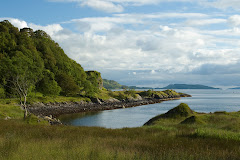
At the northeastern corner of the Yucatán Peninsula, the small island of Holbox (43km long and 2km wide) is separated from the Mexican mainland by a shallow saltwater lagoon. The 6th of June 2014 marks the 20th anniversary of the Yum Balam ecological reserve, of which Holbox forms part. I arrived on this island a week ago in the early hours of the morning of Thursday 29th May. The quiet sandy streets gave no hint of the social unrest that was to erupt a few days later.


At about 4pm on Sunday 1 June, as I was sitting in a café on Holbox plaza, chatting to a local, the church bell started to ring insistently. After taking a call on his mobile, the local said that a meeting of Holbox landowners earlier that day in Kantunilikin (a small town on the mainland) had not gone well and that the bell was calling local people to the plaza to protest. As people gathered in front of the steps of the town hall, someone speaking into a megaphone called for the old mayor to step down and for a new one to be appointed. A police car, appropriated by the locals (the police had left the island earlier that day) was parked in front of the town hall and the sound of its siren mingled intermittently with the pealing of the church bell. 


The megaphone speaker apologised to tourists for the disturbance. I moved over to a doorway where three old women were gathered, watching the drama unfold. I asked them what was going on. One woman lifted a handful of sand from the street and, letting the grains trickle through her fingers, explained that it was all about the land, land that had been stolen by rich people from locals who never read the small print on the contracts they signed. An hour later, as I wandered back through the plaza, I noticed that graffiti adorned the sign in the centre of the plaza which up to then had been celebrating the ‘DIA DE LA MARINA’ on 1 June. It now read ‘NUEVO MUNICIPIO HOLBOX. 1 DE JUNIO 2014. DIA DE USOS Y COSTUMBRES’ – the 'day of the mariners' had become the 'day of traditions and customs', under a proclaimed new (self-elected) town council. Local people occupied the plaza for the rest of that day, through the night, and the following day too. As I left the island in the early hours of the morning on the 3rd of June, I noticed that the plaza was strangely empty. But the graffiti remained.


For the sake of clarity, this article separates the conflict on Holbox into 3 separate issues:
1.     The intentional sale of waterfront plots of land in La Ensenada (an undeveloped part of Holbox uninhabited by humans) by 70 Holbox ejidatarios and the unwitting sale of these ejidatarios’ rights to the ejidales of Holbox (italicised terms explained below)
2.     The major touristic development planned by the development company Peninsula Maya Developments in La Ensenada
3.     The (shelved) management plan for the Yum Balam ecological reserve (of which Holbox forms a part)

1. The sale of plots of land in La Ensenada

On Thursday 29 May (the day I arrived on Holbox), a petition appeared on Avaaz, asking signatories to “Save Holbox Island! …if you care about the environment, life and the people living on Holbox island, which is part of the Yum Balam Biosphere Reserve.” The petition (which is quite lengthy, and in Spanish) stated that:

On Sunday 1 June 2014, an assembly of ejidatarios will vote to approve the sale of land on Holbox to the company Peninsula Maya Developments who wish to build 875 villas and condominiums, three hotels, a shopping complex, access channels and a harbour.”

The gist of the petition was that these new ejidatarios had illegally obtained their ejidales rights and that these rights must be restored to their original owners in order to stop a major tourist development, by non-local developers, going ahead on Holbox against the wishes of the Holbox community (approximately 2000 people).

In Mexico, ejidatarios are owners of common land (ejidales) and agrarian rights of distribution related to that land. The areas of common land (ejidales) remain commonly owned by the ejidatarios unless and until the ejido (a body which administers the ejidales from a headquarters where it carries out transactions and holds assemblies) decides to divide up all or part of the commonly owned land into plots which are then individually owned by each ejidatario. Together, the commonly owned ejidales make up one ejido, which, as well as being an administrative body, also refers to the entirety of the common land. So, for example, the ejido (the entirety of the common land) might be divided into different parcels (ejidales) of commonly held land, distinguished by name and geographical location. Originally, when the Mexican government granted this common land to qualifying Holboceños (Holbox natives), none of the land could be sold (either individually allocated plots of land or the land held in common) – it could only be inherited by the descendants of the ejidatarios. The law was modified during the nineties allowing the individually owned plots to be sold to Mexican nationals and to national or non-national companies. It is one thing for an ejidatario to sell his/her individual plots of land. It is quite another to sell his/her rights to the commonly owned ejido/ejidales. The difference is that even if a plot of land is sold by an ejidatario, he/she is still entitled to receive distributions akin to dividends from the ejido (for example property taxes are paid to the ejido on the sale of any plots of land and these taxes (less administration fees) are eventually distributed equally as dividends between all of the ejidatarios belonging to that ejido. In addition, if the ejido decides to divide up more of the land into individual plots, the ejidatario stands to gain more land which he/she then owns individually and can sell on). These rights are valuable – they represent a potential income stream and also the right to a defined asset at some point in the future (allocated plots of land). Those who possess these rights are legally obliged to be living in the same state as the relevant ejido (in the case of Holbox, the state is Quintana Roo) or to maintain a presence there with periodic visits to the ejido or to already own property in the ejido.

Back to the situation in Holbox. In 2004, 70 out of the 117 ejidatarios on Holbox accepted an offer from the company Peninsula Maya Developments of 5 million pesos (approx. GBP£250,000) for each waterfront plot of land (which they each owned individually as this land had been allocated by the ejido). They received payment for the sale in 2008. The other 47 ejidatarios refused to sell their plots in that area (which is known as La Ensenada). According to a local source, this has led to a huge conflict within the ejidatario community, with those refusing to sell being henceforth referred to as Los Talibanes (the Taliban). A local protest group, YDH (Yo Defiendo a Holbox – I Defend Holbox), made up of ejidatarios, claim that the waterfront plots of land were actually worth 99 million pesos (approx. GBP£5 million) each and that since they did not realise that at the time, they were cheated by the buyer Peninsula Maya Developments.

What the 70 ejidatarios more recently realised is that they appear to have sold not only their waterfront plots of land in La Ensenada to Peninsula Maya Developments, but also their related common rights to all the common land/ejidales/ejido on Holbox. Talking to locals, the consensus seems to be that the ejidatarios had been hoodwinked by rich people and hadn’t read the small print in the contracts which they signed when selling their land. In the meantime, a local rumour is that the 47 ejidatarios who previously refused to sell, have been in closed negotiations with Peninsula Maya Developments and have been offered 15 million pesos for each of their waterfront plots of land in La Ensenada. It is unclear how many of these 47 ejidatarios are simply waiting for a better price to sell their land and how many are not interested in selling at all.

The Avaaz petition presents the 70 ejidatarios calling for a restitution of their common rights to the ejidales in order to stop the major tourist development planned by Peninsula Maya Developments. The group YDH points out that that the new ejidatarios are businessmen/women from the state of Yucatan, who do not live in the state of Quintana Roo. However, the petition conflates 2 separate issues. The ejidatarios want their rights to the common land of Holbox returned to them, because, understandably, they feel that they have been swindled, having never intended to sell these rights. However, when they sold their plots of land, they must have understood that these lands would be subject to development as they were selling them to a development company – Peninsula Maya Developments.


2. Peninsula Maya Developments

Heading up Peninsula Maya Developments is Fernando Ponce García and his son-in-law Ermilo Castilla Roche. Ponce García owns Bepensa which is the company used by Coca Cola to bottle its product for the Yucatan Peninsula. The Ponce family (generally referred to as los Ponces) are well known as a wealthy, powerful and well-connected Mexican family. YDH contend that 11 or 12 years ago, Ponce, the head of Peninsula Maya Developments suggested that the ejido of Holbox should form a company in order to ‘help’ Holbox with a major tourist development. Subsequently, Peninsula Maya Developments was formed by businessmen Ponce and Castilo together with the property developer Ara and the ejido for Holbox.

I checked the website of Peninsula Maya Developments to see what kind of development they are planning for La Ensenada on Holbox. The front page of the website presents an ecologically friendly image – it states that the company will only develop 10% of La Ensenada and will ensure that the rest of this pristine habitat is protected. They will employ experts in their field to design the tourist complex and the concentration of the land in the hands of one owner (Peninsula Maya Developments) rather than a multitude of ejidatarios will protect it from badly planned future ad hoc development.

“The PMD Project promotes preservation through sustainable, nature-based tourism. This concept utilizes a fraction of the land (10%) as the base for travelers and investors who want to visit Isla Holbox because of its intrinsic natural environment. This can only be accomplished applying appropriate planning and development guidelines on most or the entire island. One owner with a single vision can plan this. A sub-divided island with multiple owners who have different interests cannot.
In order to help insure that PMD property is appropriately planned to help protect all of Holbox, PMD will infuse into the Master Plan many protective measures…”

The website provides a link to a presentation with more detail on the project – I had to register with my name and email address to gain access.

The first half of the 41-slide presentation (in English) was not hugely interesting or informative in terms of the kind of development planned. It was only on reaching slide 16, that the language started to reveal the intentions of the developers, and, in particular, the exclusive tone of the planned development.

At Peninsula Maya Developments, real estate becomes a part of the attraction of the resort. By clustering three different 50-75 room boutique hotels around a single, large ‘outdoor living room’, the three become a pivotal chapter in the story of this magical island. Each appeals to the guest seeking a specific experience – oceanic adventure, culinary arts, and wellness/life extension.”

Ironically, most of the existing hotels on Holbox (owned by locals) have between 10 and 29 rooms, with one 'large' hotel which has 68 rooms. So, ‘boutique’ hotels already exist on Holbox (in the inhabited part of the island), and many of them are pretty upmarket (see for example the eco-friendly Casa Las Tortugas). 875 private villas and condominiums are also planned as part of the PMD development which would bring an estimated 6,000 people to this currently uninhabited part of the island.

The PMD presentation goes on to describe its three boutique hotels as follows:

The three share the spectacular deck, which is organized so it serves as a dramatic entry, a signature restaurant, a pool area and a collection of quaint shops for each hotel…. They draw strength from one another and from the uniqueness of the living-room-as-a-small-village concept.”

Many small local shops, owned and run by people who live on Holbox, and selling their own goods, already exist on Holbox – in the inhabited part of the island.

The PMD hyperbole continues:

The outdoor living room is the social hub of the resort where guests and residents alike gather in a near-theatrical setting that reflects their cultural interests and casts them as players in a performance that unfolds each day and night. With the two and three storey high porticos of the three hotels as backdrops and palms and tropical shrubs and flowers as set pieces, this splendid stage provides a strong emotional connection to both the land and the sea. The 25,000 square foot living room…is its own destination within a destination.”

At this point, have a look at the video ‘130 seconds of Isla Holbox, Mexico’ which provides a good sense of what real life on Holbox is like - and how far removed the vision of PMD is from the local culture and community. The slightly longer video, Sin Holbox no hay Paraiso (Without Holbox there is no Paradise) was made by locals on Holbox about 18 months ago, seeking international help to protect their island. Locals are currently working on another video which will be released soon.


Coming back to the PMD development: according to the presentation, it will provide an ‘attractive destination for celebrity musicians’ because, amongst other things, the planned development includes a state of the art recording studio and an outdoor amphitheatre. Yet, the presentation insists, “the resort engages the Holboceños as partners in the future of the island. They are among the resorts’ decision makers.” This quietly ignores the question of whether the local people want the resort in the first place. Some may welcome it (in the hope of gaining employment and more tourist trade) but, from the conversations I had over the last few days, it seems that most locals do not want this development to go ahead. The exclusive tone of the language describing the planned development in the PMD presentation suggests that it will be anything but inclusive of the local community. The presentation’s reference (towards the end) to “community input and participation” in the development is highly dubious. What is more revealing is PMD’s description in the presentation of the project phasing:

Development will follow market demand.

Future permitted phases will remain natural environments until or unless there is demand.”

The Peninsula Maya Developments website and presentation claim that Holbox needs to be protected from unplanned and unmanaged development, and that they are best placed to do this, having an array of outside experts at their fingertips. Nowhere does the presentation (dated 2014) refer to a shelved, community-driven management plan whereby the locals of Holbox wish to regulate, on their terms, the development, and protection, of their island.

3. The management plan for the Yum Balam ecological reserve (which includes Isla Holbox)

More recently, another petition has appeared calling for the Mexican government to ‘draw up’ a management plan for the Yum Balam ecological reserve. Once again, the wording of this petition is misleading in that it suggests that a management plan does not exist. From my conversations with locals on Holbox over the last few days, I learnt that during the summer of 2011, several workshops were held on Holbox with various stakeholders (fishermen, service providers (eg hotels and tour operators), local business owners) who reached agreement (described by one local as a ‘compromise’) with the government bodies CONANP and SEMERNAT on what the Yum Balam management plan should contain in relation to Holbox. Crucially, I was told that all parties agreed that the area known as La Ensenada should be untouched – ie protected from development in the future. CONANP (Comision Nacional de Areas Naturales Protegidas) is the Mexican Commission for Protected Areas and SEMERNAT (Secretaria de Medio Ambiente y Recursos Naturales) is the Mexican Secretariat for the Environment and Natural Resources. A local who attended the workshops told me that CONANP and SEMERNAT promised that the Yum Balam management plan would be circulated by November 2011 at the latest. There is still no sign of the management plan. When stakeholders have called to find out where it is, they have received various responses: it has been drafted, finalised, printed, it is just about ready to send out…but still no management plan has appeared.

If the Yum Balam management plan were released, assuming that it restricts any development of La Ensenada, this would of course pose a problem for the major tourist development planned by Peninsula Maya Developments. Draw your own conclusions.

The Yum Balam management plan is urgently needed on Holbox for other reasons too. While I was on the island, a police patrol boat carried out a night-raid on the lagoon separating Holbox from the Mexican mainland. They seized two fishing boats with 42 illegal nets between them. There may have been other illegal nets in the water which the patrol boat could not get to. Illegal fishing in the lagoon is causing huge problems for the local fishermen on Holbox (it is a fishing community) who have noticed their stocks dwindling as the illegal nets catch more and more juveniles.


Holbox is known for its whale shark tours from May to September when whale sharks congregate in the waters off its coast. There are about 10 whale shark tour operators on Holbox. When I asked one of the operators about a code of conduct, I was told that one existed between the operators but it was not written down. Despite this verbal understanding between tour operators, not all of them abide by the same rules. For example some boats will chase after just one whale shark in the hope of fulfilling their promise to the tourists on board of being able to snorkel with these magnificent creatures. Other operators don’t join this chase and prefer to wait longer and approach the whale sharks more calmly and sensitively. Some operators had posters of rules outside their shops – but even here there were discrepancies with some listing the required distance between a snorkeller and a whale shark as a minimum of 5metres, others as a minimum of 2 metres.


There seems to be general agreement though that the captains of the boats are extremely vigilant in stopping tourists trying to touch the whale sharks. A management plan could include a written code of conduct which regulates these activities – this would then help to counter the claims of outside developers 
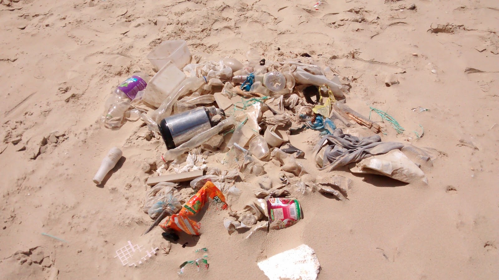
such as PMD that the ecology of Holbox is not adequately protected.

What does the future hold for Isla Holbox?

In 2005 after Hurricane Wilma, foreign aid flowed into Holbox to help with the devastation. In 2008 the 70 ejidatarios (finally) received payment from Peninsula Maya Developments for the sale of their waterfront plots of land. Locals described to me how the island has changed a lot since these two injections of cash, pointing to the increase of golf cars on the island (some families own more than one car per family) and the construction of 2 storey concrete houses compared to the traditional one storey palapas (thatched with palm fronds). It is undeniable that local development on Holbox is happening and that the island is changing.


At the start of this article I described how locals had gathered in the main square of Holbox on 1 June to protest at the outcome of a meeting in the mainland town of Kantunilkin. This meeting was an assembly of the Holbox ejido with the new ejidatarios to approve the division of Holbox into four ejidos (Peninsula Holbox, Isla Holbox, Holbox and Punta Holbox). Outside the meeting, while the new division of Holbox was approved by 70 out of 117 ejidatarios, the police prevented the former (disenfranchised) ejidatarios from entering the assembly. The injury of an elderly ejidatario after the meeting (when the car of the director of public security for local government ran over the elderly gentleman’s foot and then continued without stopping) prompted the crowd to attack the vehicle with stones. The police responded by firing tear gas at the crowd. This was the prequel to the church bell ringing in the plaza of Holbox a few hours later and the locals' occupation of the town hall – in an attempt to force the government to talk to them about their grievances. On 2 June, a delegation of the former ejidatarios travelled to Cancun to talk to the Secretary for the government of the state of Quintana Roo. On the return of this delegation, later that evening, they surrendered the town hall and disbanded the occupiers, on the basis (and in the hope) that the 1 June assembly may be declared void.


This conflict raises difficult questions. For example, if the rights to the common land of Holbox were returned to the 70 old ejidatarios, would they still be calling for protection of Holbox against a major tourist development or would they sell these rights (which they now know are worth a lot of money) to the next bidder? They were prepared to sell their plots of land to a developer in 2004. Where was their concern for protecting the environment of Holbox, and their children’s heritage, then? Or have they realised that the money from the sale of their lands has not improved their quality of life as much as they imagined and has cost them a lot more in terms of loss of heritage, and perhaps even identity?

Can the community on Holbox come together despite the divisions which exist between the former ejidatarios and Los Talibanes, the ejidatarios who would not sell, and some or all of whom who may have now agreed to sell via closed discussions with PMD? Can the community, which consists of native Holboceños and incomers who have developed local businesses there (such as the beachfront hotels) and who mainly work in the tourist industry, agree on a vision for the island whereby the island’s culture and ecology is managed by the people who live there?

Perhaps the only thing that is clear from the tangled conflict on Holbox is that self-management via a government-supported and resourced management plan, by a local community who live on and know their island, is preferable to 'management' by outside property developers who claim to have the best interests of the island’s ecology, culture and its community of 2000 people at its corporate heart.


Sunday, May 11, 2014

Crocodile-fish, manatees and 4 wooden clothespegs


It all started with a man with a map walking down the street in Palizada, Pueblo Magico (the magic town), with its terracotta-tiled roofs from Marseille. Samuel, the man with the map spotted some of our group on the street, a meeting was set up and the next day saw us poring over his 2 maps of the Usumacinta River ( a delta system) and its tributaries, one of which is the Palizada River.

Samuel told us about a small population of manatees who live in a freshwater lagoon - visible on the map but usually not accessible in the dry season (up to the beginning of June) to the fishermen who fish that territory. There is (as yet) no organised way for the general public to access the lagoon. The narrow and shallow waterways which lead to the lagoon are filled with water-lilies and their trailing root systems make it impossible for motor boats to pass through. But this year because of two unusual rains in late April, Samuel thought that these waterways might be passable in fishermen´s cayucos (traditional wooden kayaks). Two days later, 6 of us found ourselves in a field outside Palizada with an array of overturned cayucos and about a dozen fishermen tretrieving oars from the branches of the surrounding trees. We were a little puzzled as we couldn´t see any water anywhere near the cayucos, although the land was boggy underfoot. As the first cayuco was turned upright and dragged forward by a coiuple of the fishermen, we realised that what appeared as a mass of green vegetation on land was actually a dense carpet of aquatic plants in about 40 centimetres of water.

While the fishermen stood with perfect balance at either end of each cayuco, using long oars to push us forward, each expeditionary sat in the middle of their designated vessel, almost at a level with the water, watching the incredible bird and plant life unfold as we slowly edged our way through to the lagoon over the course of about an hour and a half. We never saw any manatees (according to the fishermen there is a population of 8 resident there at the moment) when we eventually reached the lagoon which measures about 8km by 300 metres. Nor did we see any of the 4 metre crocodiles who apparently inhabit it - they are shy and stay underwater...unless you fall in, in which case they eat you. But I learnt a lot about the practices of the freshwater fishing community of this particular fishing territory in Campeche, as I happened to be accompanied by a particularly chatty and obliging fisherman.

Fishermen´s groups exist in the different fishing territories of the state of Campeche (and, I understand, in the other coastal and freshwater Mexican states). As I am used to talking to Irish and Scottish fishermen, I was somewhat surprised when Juan, the chatty fishermen described a relationship free of antagonism between the local fishing community (77 freshwater fishermen in that territory) and local government. Applying for a fishing permit appears to be a straightforward and trouble-free process. It seems that 14 years ago the Mexican government decided to create specific fishing territories for fishermen as stock levels were dropping. Each territory has a fishing group composed of the fishermen in the area, with responsibility for taking care of that area and its fish stocks, and each cayuco in this case has a chip which tracks its location. If a fisherman breaches his territorial limit, he loses his fishing permit for good. The fishing is protected on two levels - by law via local government (who enforce the territorial limits as described above) and by agreements reached between the fishermen themselves which are not legally enforceable and depend on mutual respect between fishermen. According to Juan, it works. The fishermen agree how many days each month they will fish - they may limit their fishing to 3 specific days in the month, or more if stocks appear more abundant (they seem to fish in groups of 3 days at a time). The amount they fish prvoides them with enough fish to feed their families, to sell on the market and to allow stock levels to regenerate. As there are only 3 entrances to the lagoon, it is easy for the fishermen to self-monitor and see if any of the group is not respecting the agreement reached that month. I was unable to find out what happens if a fisherman does breach the agreement - in fact Juan seemed puzzled by the question (which I asked several times) and kept referring to respect between the fishermen. During the 3 months when the freshwater fishermen cannot acess the lagoon (until recently this was the case from end February to the beginning of June) the local governemnt agency in charge of the fishing territory pays each cayuco owner 1500 pesos (about 75 sterling), 500 pesos for each month, which he splits evenly with his crew member. However, he did note that relationships between the sea (alta mar) fishermen are more fraught, as illegal fishing there is more prevalent and there is less respect between the fishermen.


Juan has observed significant changes in the climate of the area over the last 8 years - more rain, and more and stronger hurricanes. Before this year they would never have been able to access the lagoon in May and this is the first year that the land has not completely dried up during the dry season More rains mean that there are more waterways opening up through the boggy land around the lagoon, but less land for the neighbouring cattle farmers to work with every year. The lagoon conditions are affected by the sea conditions in the Gulf of Mexico (where the initial pair of lagoon manatees travelled from) which can create huge waves in the lagoon, sometimes forcing the fishermen to camp out for several days until safe conditions return. Fishing there is easy according to Juan, in tbat thre are always fish to catch. Species caught include the valuable and meaty pes lagarto (crocodile fish, so named because it looks like a miniature crocodile), 4 different species of mojara, and savalo (which is no longer allowed to be sold on the market and is only for private consumption).

As we floated over the lagoon I asked Juan if there were aby stories about the area which the fishermen told their children. theere was a moment´s silence as I saw him hesitate - then he called to one of the other fishermen ´She wants to hear the stories...´. It was almost as if he was asking for permission. Lowering his voice, Juan started to tell me about the fishermen who have disappeared in this lagoon, and in other lagoons in the area. Fishermen who have been struck down with inexplicable fever. And the light. Juan himself has seens the light several times, but not in the last 15 or so years. The first time he saw it, he was fishing the lagoon by night, and he thought it was a big star. But then he and his crew member realised it was too big to be a star and that it was moving towards them at a great pace. They remembered the stories they had been told and put out their own night light on the cayuco and started to move their cayuco in curves in stead of straight lines. This makes it hard for the evil light to find them - according to the older fishermen it is because of the evil light that people disappear. When the light appeared, Juan said that the wind dropped and everything became eerily still. As they evaded the light, it stoped moving and then disappeared and the wind picked up again. They were safe.


And the 4 wooden clothespegs? They are by far the most useful items I have brought with me on this expedition. More on that in the next post.